Résultats de la recherche : "Delavau" 203 résultats
Notice d'illustration
IVR53_19975601237X
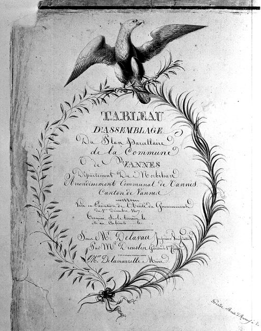
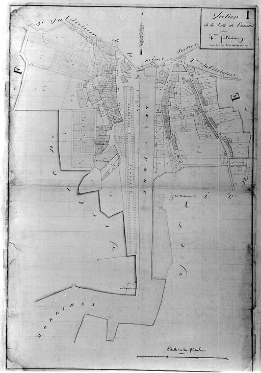
Présentation de la commune de Vannes
Plan cadastral 1807-1809. Tableau d'assemblage général : détail de la vignette. AM Vannes 21Fi.
Notice d'illustration
IVR53_19975601177X
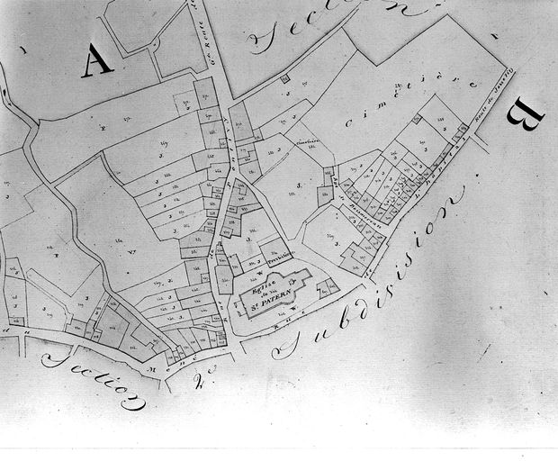
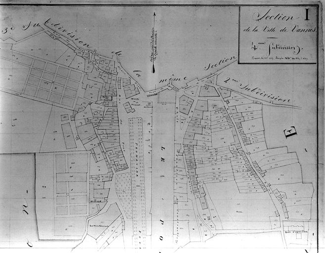
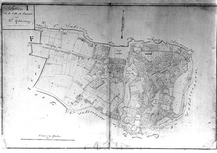
Rue Saint-Nicolas (Vannes)
Plan cadastral 1809. Section I1 : quartier Saint-Patern, partie nord. AM Vannes 21Fi.
Notice d'illustration
IVR53_19975601174X
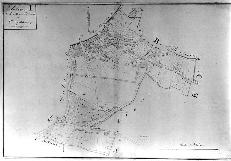
Rue Saint-Nicolas (Vannes)
Plan cadastral 1809. Section I2 : partie est de la ville. AM Vannes 21Fi.
Notice d'illustration
IVR53_20025604624NUCA
Maison, 1 rue Thiers (Vannes)
Plan cadastral 1809. Section I4 : partie de la rue du Drézen.
Notice d'illustration
IVR53_20095605135NUCA
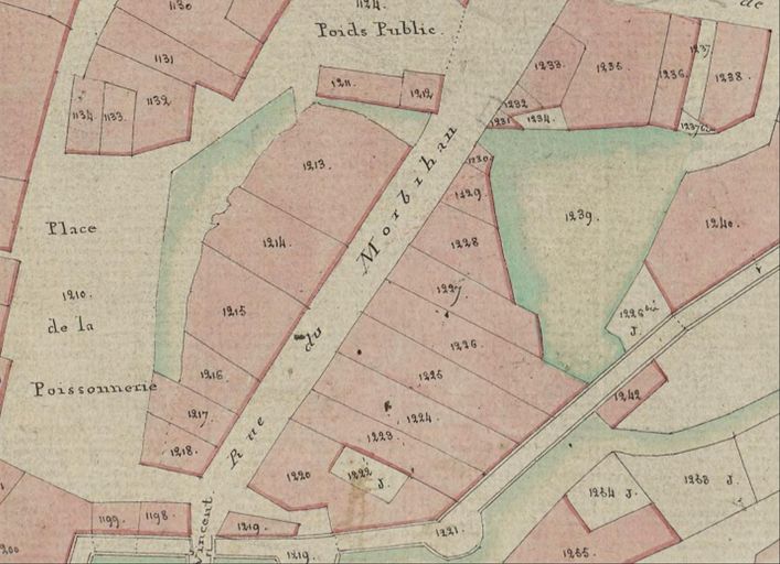
Maison, 5 rue Saint-Vincent ; place de la Poissonnerie (Vannes)
Plan cadastral de 1807 : section I3, détail rue Saint-Vincent. AD Morbihan 3P297/22.
Notice d'illustration
IVR53_19975601168X
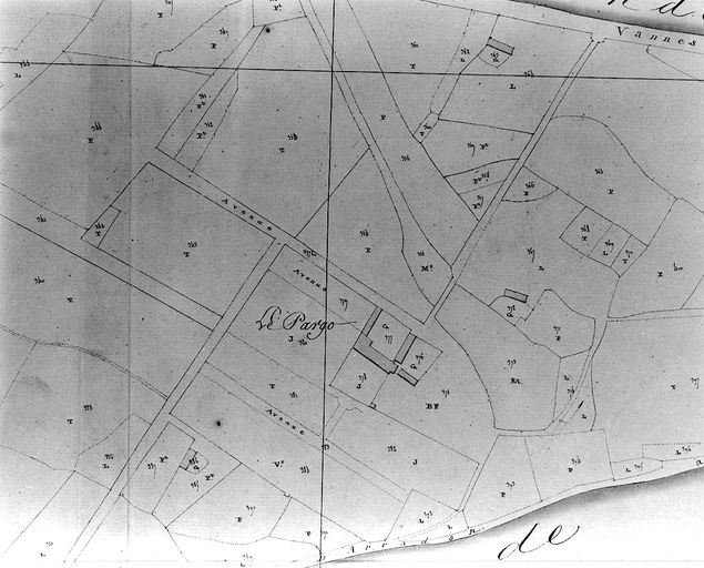
Rue dite impasse de la Marne (Vannes)
Plan cadastral 1809. Section G2 : le Pargo. AM Vannes 21Fi.
Notice d'illustration
IVR53_19975601189X
Hôtel Billy, Place Gambetta (Vannes)
Plan cadastral 1809, section I4. AM Vannes 21Fi.
Notice d'illustration
IVR53_19975601188X
Maison, 13 rue Richemont (Vannes)
Plan cadastral 1809. Section I4 : port, partie nord. AM Vannes 21Fi.
Notice d'illustration
IVR53_19975601175X
Maison, 20 rue Saint-Patern (Vannes)
Plan cadastral de 1807. Section I2 : quartier Saint-Patern, partie nord-est. AM Vannes 21Fi.
Notice d'illustration
IVR53_19975601176X
Rue du Maréchal Leclerc, anciennement rue de la Petite Garenne puis rue du Roulage (Vannes)
Plan cadastral, 1807-1809, section I2. AM Vannes 21Fi.
Notice d'illustration
IVR53_19975601181X
Lavoirs de la Garenne, 15 rue Porte Poterne (Vannes)
Plan cadastral 1809, section I3. AM Vannes 21Fi.
Notice d'illustration
IVR53_19975601182X
Maison, 4 ruelle de la Porte Notre-Dame (Vannes)
Plan cadastral 1807. Section I3 : intra-muros, partie nord-est. AM Vannes 21Fi.
Notice d'illustration
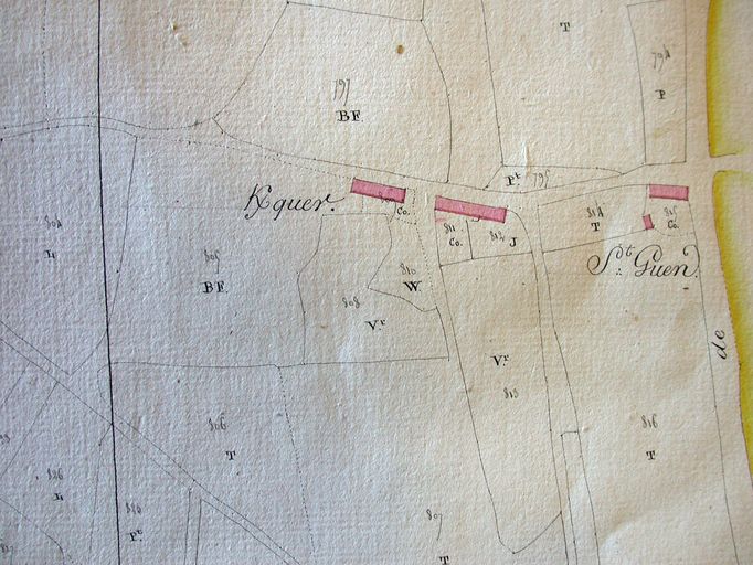
IVR53_20055604966NUCA
Ferme de Kerquer, rue du 10e Régiment d'Artillerie (Vannes)
Plan cadastral 1809, section. AM Vannes 21Fi.
Notice d'illustration
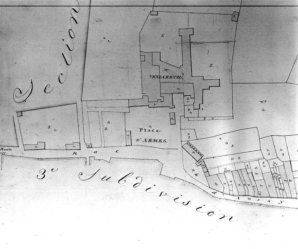
IVR53_19975601179X
Maison, 2 place Nazareth (Vannes)
Plan cadastral 1809. Section I1, partie nord-ouest : couvent de Nazareth, rue d'Auray. AM Vannes 21Fi.
Notice d'illustration
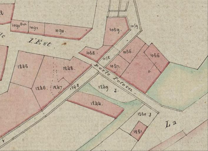
IVR53_20095605157NUCA
Lavoirs de la Garenne, 15 rue Porte Poterne (Vannes)
Plan cadastral de 1807 : section I3 détail porte Poterne. AD Morbihan 3P297/22.
Notice d'illustration
IVR53_19975601186X
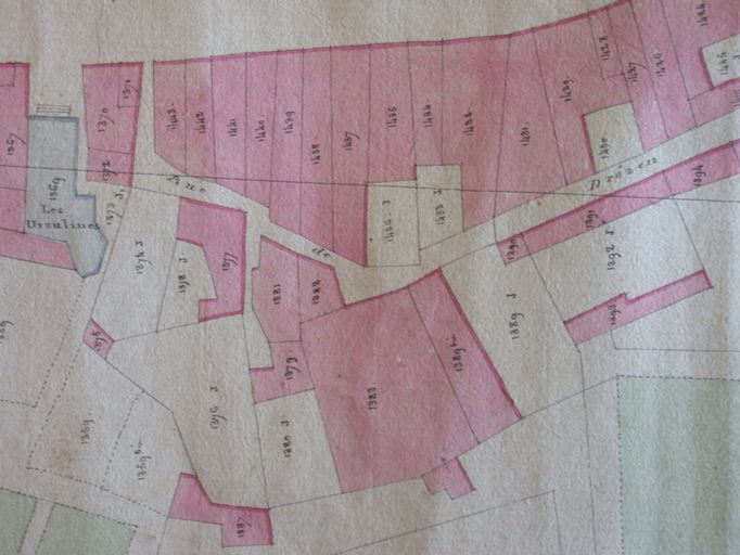
Maison, 13 place de la Poissonnerie (Vannes)
Plan cadastral 1809. Section I3, centre : intra-muros, partie sud-ouest (parcelles1205). AM Vannes 21Fi.
Notice d'illustration
IVR53_19975601236X
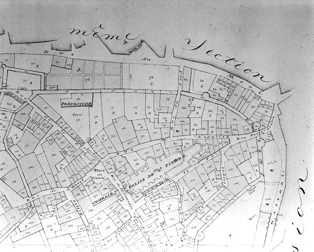
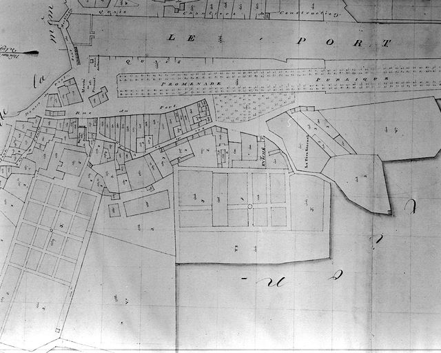
Maison, 14 place Gambetta, rue Thiers (Vannes)
Plan cadastral 1809. Section I4 : port, partie ouest, de la rue de l'Unité au couvent du Père Eternel. AM Vannes 21Fi.
Notice d'illustration
IVR53_19975601183X
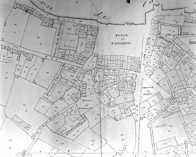
Immeuble, 7 rue Thomas de Closmadeuc (Vannes)
Plan cadastral 1809. Section I3, partie médiane : place Napoléon, haut de la rue Thiers, faubourg Saint-Salomon. AM Vannes 21Fi.
Notice d'illustration
IVR53_20045605045NUCB
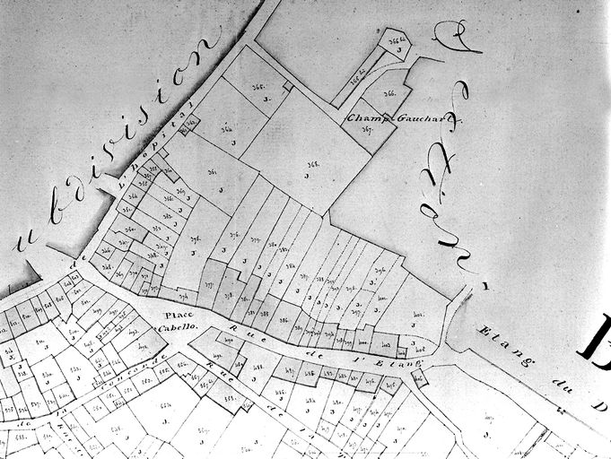
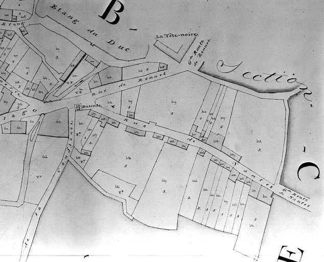
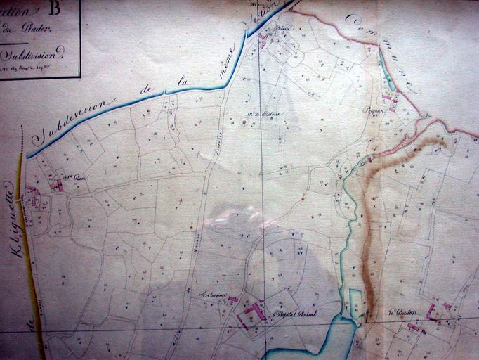
Ancien chemin de Saint-Guen puis rue du 65e R.I (Vannes)
Plan du cadastre 1807-1809 : section B (deuxième feuille) dite du Grasdor. AM Vannes 21Fi.
Notice d'illustration
IVR53_20105606621NUCA
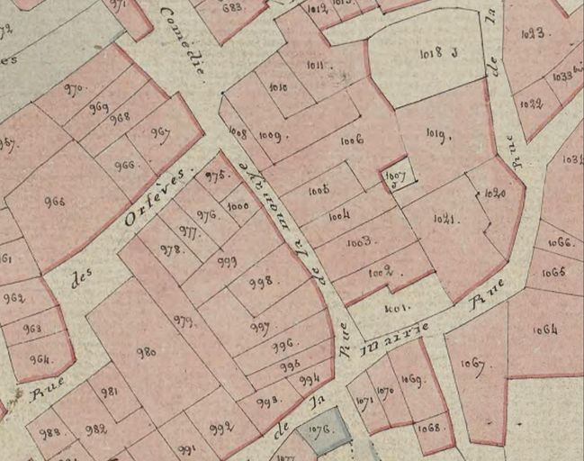
Maison, 10 rue de la Monnaie (Vannes)
Plan cadastral 1807. Section I3 : ville close, rue de la Monnaie. AD Morbihan 3 P 297/22.